What: 100 mile and 100 kilometre run
Where: Brindabella Ranges, Namadgi National Park, ACT
When: 0600 Namadgi Visitors Centre ** To Be Advised **
How: You will run under the auspices of Fat Ass World
Cost: $0.00
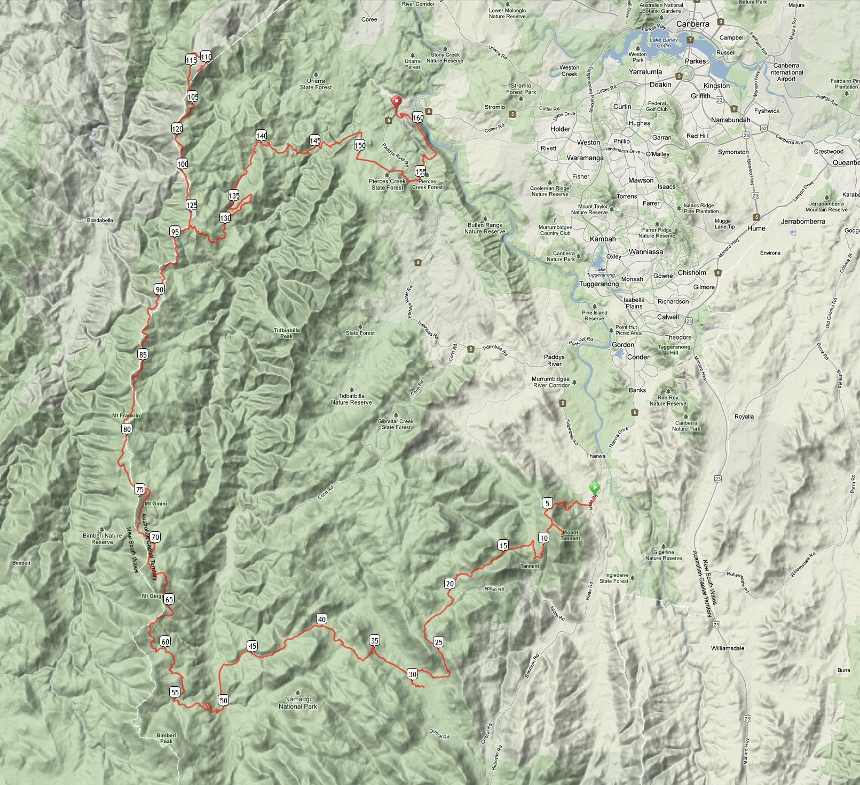
Brindabella 100 A Big run with Big hills and Big views. 100 miles and a 100 kilometre option of fantastic scenery which showcase the Brindabella Ranges in Namadgi National Park ACT. The short section of single track and fire roads are reasonably easy to follow with steep and rocky sections, good leg lift is required. The course starts with the steep single track up Mt Tennent. To the first crossing of the Cotter River involves smaller hills with gentle ascent. It is a long and steady climb to gain the Brindabella Range. Mt Franklin Road continues on to Mt Ginini and Bulls Head. Two Sticks Road leads to a very steep ascent and descent of Mt Coree via the summit fire road. After returning to Bulls Head there is a long but gentle descent to the second crossing of the Cotter River at Vanitys Crossing. Finally a sting in the tail awaits runners ascending Bullen Range from Murrays Corner before descending to the finish at Cotter Bend. With 4600 metres of climbing and 4700 metres of descent in remote areas, this hill grinding odyssey is not suitable for a first attempt at covering 100 miles. Water, GPS files, navigation notes and drop-bag support will be provided. The Fat Ass concept means that this run is neither an event nor an organised activity, but simply an informal collection of self-reliant, like-minded people in the same place at the same time.

